Boing Boing

Boing Boing

Share this post

Boing Boing
Boing Boing
Ultra-detailed map of U.S. rivers
Copy link
Facebook
Email
Notes
More

Ultra-detailed map of U.S. rivers

Rob Beschizza
Jan 23, 2025
∙ Paid
4

Share this post

Boing Boing
Boing Boing
Ultra-detailed map of U.S. rivers
Copy link
Facebook
Email
Notes
More
2
Share

The National Hydrography Dataset Plus High Resolution map of waterways, created by the US Geological Survey, is the highest-resolution survey of its kind.

USGS

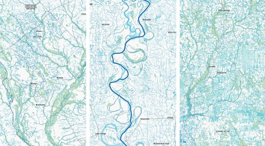
With nearly 25 million rivers, streams, pipe lines, and other linear features, over 7 million lakes, ponds, reservoirs, wetlands, and other area features, and exciting new cartography, the new high…

Keep reading with a 7-day free trial

Subscribe to Boing Boing to keep reading this post and get 7 days of free access to the full post archives.

Already a paid subscriber? Sign in
© 2025 Happy Mutants LLC
Privacy ∙ Terms ∙ Collection notice
Start writingGet the app
Substack is the home for great culture

Share

Copy link
Facebook
Email
Notes
More